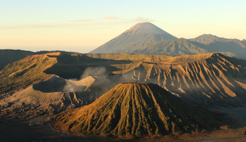
Mount Bromo Facts
- Mount Bromo is an active volcano, which is part of the Tengger massif, in East Java, Indonesia, in Asia. It is not the tallest peak in the massif but is by the far the best known.
- It also stands approximately 7,641 feet (2,329 m) in height.
- The massif is part of the Bromo Tengger Semeru National Park and sits in the middle of a vast, barren plain called The Sea of Sand.
- During inactive periods, Mount Bromo is a popular tourist site in the region. The volcano itself sits inside the much more massive Tengger caldera, which is about 6.2 miles (10 km) in diameter.
- Even during its passive periods, the volcano routinely sends out plumes of sulfurous smoke. Its latest eruption was on January 22-27, 2011.
Related Articles
Mount Bromo Landscape
In this image, you see the stark, other-worldly landscape which surrounds Mount Bromo, and the entire massif. The area is a seemingly barren wasteland.
Even during the extended periods of calm, occasional small tremors may make footing treacherous. Despite this fact, tourists flock to the volcano during these periods of relative quiet.
The starkness of the landscape remains an extreme contrast to the lush, tropical climate surrounding it.
Mount Bromo Caldera
Here you see the inner caldera of Mount Bromo. The plume of sulfurous gas is an almost constant presence, even when the volcano is otherwise inactive.
During these times, people mine the inner walls of the caldera for the valuable sulfur that the steady plumes of gas deposit.
Mount Bromo Remoteness
Another view of the stark beauty of the landscape of the geology of the region. The visual contrast makes for a rather striking image. Also, the entire region, including the National Park, is protected since 1919.
The nearest village is approximately a 45-minute walk away and is the most common departure point for visitors. For obvious reasons, vehicles cannot go through the area.
Mount Bromo Eruption
This is a photo of the actual eruption of January 22, 2011, at approximately 5:30 a.m. local time. The ash cloud reached a rather amazing height of 18,000 feet (5,486 m) and also extended to the southeast of the caldera a distance of 200 nautical miles (370 km).
While not especially violent, the cloud of ash disrupted air traffic to the surrounding regions for days.
Features Sharing Its Region
Check out our other articles on 7 Truly Astounding Geological Wonders, Eurasian Red Squirrel, Orinoco River, Sydney Funnel-web Spider, Heartleaf Foamflower, Weka, Jamaican Iguana

