We sincerely hope that you enjoy this article about 7 Geological Marvels of Asia. To be certain, every part of our world has many stunning sights to behold. However, this region of the world seems to teem with such wonders of Nature. They come in all forms and sizes, of course. So, sit back and enjoy. We assure you that these 7 Geological Marvels of Asia are only the beginning of the natural wonders to be found throughout the world
Borra Caves
CCL: https://bit.ly/2XJI00e
Borra Caves Facts
- Leading off this article about 7 Geological Marvels of Asia is the stunning location known as the Borra Caves.
- Firstly, the incredible location known easily ranks as one of the largest known caves in the country in which it formed. Secondly, the truly magnificent site also holds yet another impressive status. That’s because the fabulous site ranks as the deepest known cave in that same country. Quite surprisingly, it also sits at an usually high altitude.
- In addition, the local indigenous population long knew of the natural marvel. In fact, they knew for countless centuries prior to its discovery by Europeans. However, the breathtaking caves first became known to outsiders in 1807. This occurred as a result of a geological survey of the country.
- Finally, this truly fabulous natural site has one more reason to stand out. That’s because the Borra Caves also plays an important role in the religious beliefs of the local population. As part of these beliefs, the native residents hold several legends revolving around the astounding caves. In fact, this even extends to the construction and maintenance of a small temple outside its opening.
CCL: https://bit.ly/2qNNNps
Borra Caves Physical Description
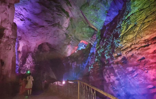
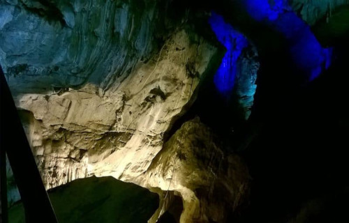
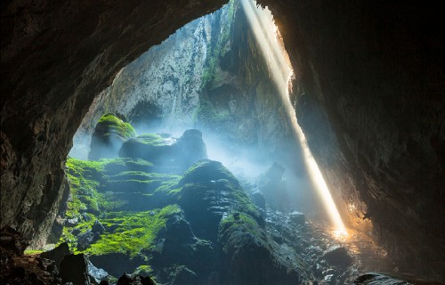
Perhaps most notably of all, the endlessly amazing Borra Caves extend for a relatively great distance. That’s due to the fact that they have a total length of about 660 ft (200 m). However, it also boasts a remarkably large opening. This measures roughly 330 ft (100 m) in width, and about 246 ft (75 m) in total height.
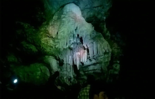
Furthermore, this well known and always fascinating site also boasts numerous natural features, especially stalactites and stalagmites. The wondrous stalactites range in length from 0.3 – 11.5 ft (0.1 – 3.5 m) in length. Meanwhile, the equally marvelous stalagmites have an average length of 3.9 ft (1.2 m).
Yet, the incredibly stunning location also boasts even more magnificent features to dazzle the observer. That’s because the site also contains numerous fascinating limestone columns. These comparatively massive features average roughly 20 ft (6 m) in height and about 2.5 ft (0.75 m) in overall width.
But the marvels of the Borra Caves do not simply stop there. Nature worked multiple wonders in this location. In point of fact, the surrounding area consists largely of impressive mica formations. Due to the unique nature of this site, numerous precious stones also appear in the mica, including rubies.
CCL: https://bit.ly/2pQ8WPz
Borra Caves Location, Formation, and Ecology
First of all, the magnificent Borra Caves formed in a remarkable part of the world. This marvel of Nature formed on what now represents the East Coast of the country of India, in Asia. Rather more specifically, this geological wonder formed in what is now the Ananthagiri hills, in the district of Andhra Pradesh.
Furthermore, the Gosthani River created the incredible site, since it actually originates within the caves, before flowing onward. In fact, its actions, over countless thousands of years, carved the caves as they exit now. It did this through its inexorable actions against the relatively soft limestone of the region.
However, while it may seem like an inhospitable location, life actually teems within the boundaries of the Borra Caves. For one, several species of fauna inhabit the caves. These mainly include various types of bats, and the golden gecko. But, it also serves as home to several varieties of tiny crustaceans.
Finally, very strong evidence further indicates that this fantastic site was known to ancient man as well as modern. This holds true due to the fact that researchers discovered numerous archaeological artifacts within the confines of the caves. To their amazement, some of these date back roughly 50,000 years.
Pearl Shoal Waterfall
Pearl Shoal Waterfall Facts
- The next of our choices for inclusion in this compilation of 7 Geological Marvels of Asia is the gorgeous Pearl Shoal Waterfall.
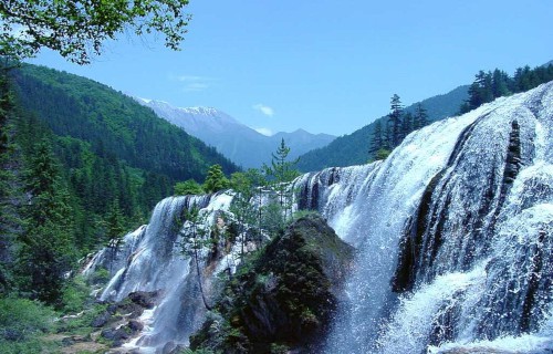
- Perhaps most notably, the highly descriptive term serves as the name of a truly stunning work of nature. Quite understandably, the breathtaking natural formation holds a special honor in the minds of many people. That’s because it continues to be considered by many individuals to be the most beautiful waterfall found in its region.
- In fact, this fabulous creation of Nature formed in a region of the world already well known for its great beauty. That’s due to the fact that the stunning cascade lies within what now constitutes the confines of a protected area. That area now forms what has been designated as the Jiuzhaigou Nature Reserve. Thankfully, this provides it with a measure of protection.
- Given the extreme beauty of this magnificent waterfall, its fame is fully understandable. However, with the Pearl Shoal Waterfall added to its numerous other features, this fabulous corner of the world has become quite well-known. In addition, due to its great natural beauty, the Reserve represents both a World Heritage Site and a World Biosphere Reserve.
Pearl Shoal Waterfall Physical Description
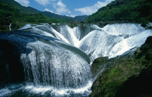
The staggering beauty of the Pearl Shoal Waterfall perfectly demonstrates one principle. That’s the fact that beauty isn’t dependent upon physical size. That holds true due to the fact that the wondrous cascade has a moderate height. Nevertheless, Nature did bless the feature with a very respectable total width.
This breathtaking wonder of Nature possesses an upper level with an average width measuring about 550 ft (163 m). However, that dimension frequently changes somewhat. This variability occurs due to the simple fact that rainfall amounts in the region vary. In addition, its drop measures around 130 ft 940 m).
Finally, though, none of these are why Pearl Shoal Waterfall earns its fame. In point of fact, that originates with the astounding action that happens as it descends. That’s because the water of the site flows over a series of uniquely placed outcroppings. This action creates an incredible interlocking pattern of flows.
Pearl Shoal Waterfall Location and Ecology
The magnificent Pearl Shoal Waterfall formed in a region of the earth already renowned for numerous beautiful natural sites. That statement holds true due to the fact that it formed on the continent of Asia. Even more precisely, this waterfall resides in what now constitutes Sichuan Province, in China, to be exact.
Furthermore, this magnificent marvel also helps play a role of relative importance in its region. That occurs because it also represents a small portion of the incredible and expansive Yangtze River system. As a result, it forms a part of a natural system that has a vital impact on the region that it flows through.
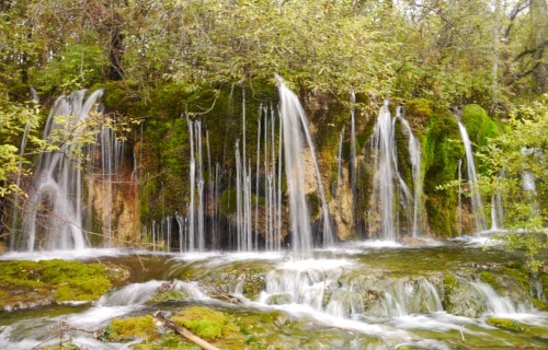
The water flowing over the gorgeous Pearl Shoal Waterfall remains extremely rich in minerals, such as calcium carbonate, which gets deposited in quantity. Finally, this mineral build up is so strong that allows plants and even small trees to actually grow within the middle area of the falls themselves.
Kelimutu
Kelimutu Facts
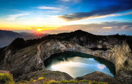
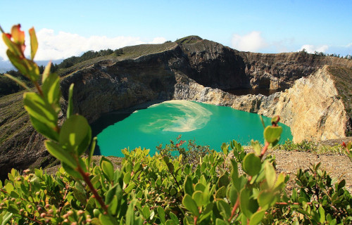
- Placing third on this list of 7 Geological Marvels of Asia, though only due to random selection, is the stunning Kelimutu.
- The incredible marvel of nature with the simple name stands out from others of its kind as a truly remarkable volcano. Furthermore, this impressive geological feature earns that unique distinction for a truly remarkable reason. That’s because this marvel of geology represents one of the few known volcanoes to actually possess a total of 3 calderas.
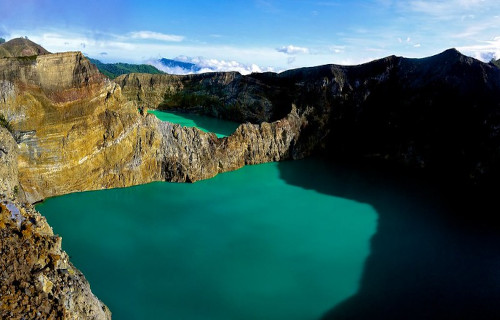
- However, the simple fact that it possesses such an almost unheard of number of calderas isn’t the only reason for its fame. In point of fact, the magnificent site holds yet another startling secret. That’s because each of these separate depressions also contains a lake. But the wonders don’t end there. Each of these surprising lakes also contains different colored water.
- In addition, the lakes of Kelimutu only partially attain their colors as a result of the activities of the volcano. The volcanic gases emitted by fumaroles in the crater also interact with chemicals in the water of each lake. The colors of the bodies of water actually change from time to time as a result of random periodic alterations in their chemical composition.
Kelimutu Physical Description
The mesmerizing beauty of Kelimutu isn’t its only respectable statistic. It also has some other characteristic worth admiring. For one, it also resides at an altitude of roughly 5,377 ft (1,639 m) above sea level. In addition, two of the calderas actually have a shared wall, while the third sits a short distance to the west. The walls of each one vary in height, with the highest prominence being 157 ft (48 m).
The lone lake to the west typically displays blue water. Meanwhile, the other two calderas of the astounding volcano, that share a wall, typically display green and red water. In addition, these gorgeous colors also change periodically. Somewhat surprisingly, these hues sometimes include brown and black. Finally, geologists consider Kelimutu inactive since the last eruption was in 1968.
Kelimutu Location and Nature
The stunning masterpiece created by the forces of Nature that mankind calls Kelimutu lies in a somewhat remote portion of the world. More precisely, the marvelous volcano sits on an island bearing the name of Flores. This location lies in the section of the earth known as Indonesia, in Asia.
In addition, the summit of this volcano has become highly elongated over time. This formative action occurred as a direct result of geological forces. Due to their slow but irresistible efforts, the site now has a roughly rectangular shape. Furthermore, many small fumaroles also populate the floors of the calderas.
The powerful gases released by these fumaroles also have a direct bearing on the coloring of the waters. That’s because these strongly interact with the various chemicals and minerals inherent to the individual lakes. The resulting colors, therefore, due to wholly random combinations, present differently as well.
Finally, the staggering site of Kelimutu sits alone in its area. In fact, even today, the nearest populated area remains the town named Moni, by the locals. This residential area sits approximately 50 mi (80 km) away from the volcano. Despite its remoteness, however, it has become a popular tourist attraction.
Ban Gioc-Detian Falls
Ban Gioc-Detian Falls Facts
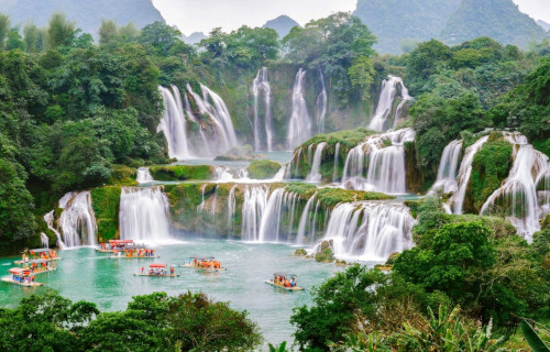
- Our next selection to appear in this compendium of 7 Geological Marvels of Asia is the mesmerizing Ban Gioc-Detian Falls.
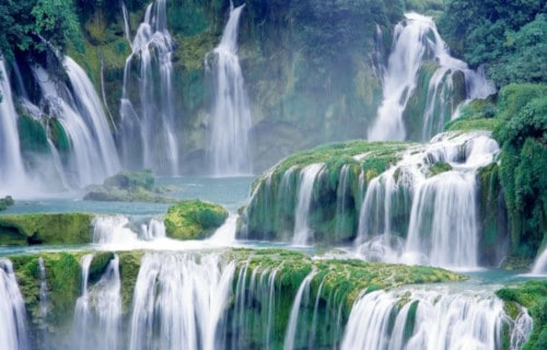
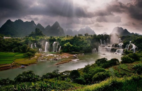
- The somewhat complex term serves as the accepted name of a truly spectacular sight. That’s because it names a set of twin waterfalls situated on the Quay Son River. Coincidentally, this marvel of Nature formed in a location almost perfectly straddling the Sino-Vietnamese border, in Asia.
- Firstly, one half of the breathtaking falls sits in the karst hills of Daxin County, in the province of Guangxi, in the country of China. Meanwhile, the other half sits in Trung Khanh District, Cao Bang Province (Vietnam). The truly wondrous site also sits roughly 169 mi (272 km) north of Hanoi.
- Furthermore, this marvel of Nature holds a very impressive position in the minds of geologists. That holds true due to the fact that these falls currently rank as the 4th largest waterfall along a national border. Only the astounding Victoria Falls, Iguazu Falls, and Niagara Falls exceed it in this.
- In addition, the Vietnamese people consider the two falls comprising what many call Ban Gioc-Detian Falls to be two parts of one waterfall. They know if by the sole name Bản Gioc. Furthermore, the two parts are named thác chính, the main waterfall, and thác phụ, the subordinate waterfall.
Ban Gioc-Detian Falls Physical Description
Creating confusion for some people, Chinese texts sometimes name Ban Gioc-Detian Falls simply the Détiān falls. By either name, though, this cascade remains a site of stunning natural splendor. Further, during the summer rains, the two waterfalls sometimes join together. The waterfall drops a total of about 98 ft (30 m) and is separated into three falls by numerous rocks and trees.
This magnificent site also earns respect for a somewhat unexpected wonder. That actually holds true due to its incredible volume. In point of fact, on most days, the thunderous effect of the water hitting the cliffs remains audible from a great distance. The Ban Gioc-Detian Falls was also one of the crossing points for the Chinese army during the brief Sino-Vietnamese War.
Ban Gioc-Detian Falls Ecology
Near Ban Gioc-Detian Falls lies yet another wonder of the works of Nature. That’s the site known to man as the gorgeous Tongling Gorge. Remarkably, this remains accessible only through a cavern from an adjoining gorge. Rediscovered only recently, it has many species of endemic plants that exist only in the gorge.
In the past, this cavern itself actually served as a hideout for local bandits. In fact, numerous treasures are occasionally still found in the cliff-side caves of Ban Gioc-Detian Falls. A road running along the top of the falls also leads to a stone marker that demarcates the border between China and Vietnam in both Chinese and French.
However, to no great surprise, modern disputes arose pertaining to the accuracy of this marking. This occurs due to the fact that there are discrepancies as to the correlating legal documents on border demarcation and the placement of markers between the French and Qing administrations in the 19th century.
Lake Kaindy
Lake Kaindy Facts
- The fifth spot on this listing of 7 Geological Marvels of Asia is held by the astounding site known as Lake Kaindy.
- To begin with, the truly extraordinary geological marvel actually has a remarkably recent time of origin. That’s because this marvel also has a highly unexpected characteristic to it. That’s because the wondrous site actually formed relatively recently due to an earthquake.
- In addition, the water remains quite cold, regardless of the time of the year. This occurs due to a specific combination of factors. Because of these, the water temperature of the lake rarely rises above 43 F (6 C). These conditions have therefore aided in creating a truly remarkable location.
- Though the location of the lake can’t be called particularly remote, the surrounding terrain has a somewhat daunting nature. That’s due to the fact that the terrain of the region can be quite rugged. As a result of this, the scenic beauty of Lake Kaindy still receives relatively few visitors.
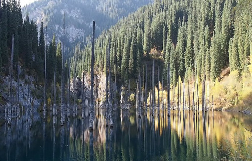
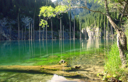
- Perhaps the most noteworthy physical aspect of the remote lake actually involves what lies within the lake itself. That’s because its pristine waters contain a surprise for those who visit it. It holds a small forest, which has been completely upturned and preserved relatively unchanged.
Lake Kaindy Physical Description
Firstly, it bears mentioning that, even without the startling presence of the bewildering flora within it, Lake Kaindy remains a lovely sight to behold. Secondly, this holds true, in part, due to the gorgeous color of the typically placid waters. This wonder only serves to augment its visual appeal to even greater heights.
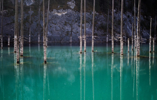
That’s because the frigid waters of the natural marvel maintain a dazzling hue. In point of fact, these present a brilliant bluish-green hue at all times. This occurs due to the strong presence of limestone deposits in the surrounding rocks. Over the passage of time, minerals from these slowly erode into the water.
Furthermore, the stunning body of water also possesses a generally irregular, oblong shape. In addition, this irregular shape understandably varies slightly as water levels rise and fall. This occurs due to variations in rainfall amounts and periodic droughts. However, the lake does maintain a roughly equal maximum depth.
Overall, this measured depth typically equals approximately 98 ft (100 m). Therefore, it remains a comparatively shallow body of water, compared to others. Additionally, the beautiful Lake Kaindy also possesses a surprising maximum length. To be precise, this dimension actually equals about 1,300 ft (400 m).
Lake Kaindy Location, Formation, and Distinctiveness
The incredibly mesmerizing Lake Kaindy formed in a remote section of the country of Kazakhstan, located in central Asia. More precisely, however, the remarkable site lies about 80 mi (129 km) east of the city of Almaty. Quite fortunately for those who deeply appreciate and value Nature, this location coincidentally lies within the borders of the Kolsai Lakes National Park.
Furthermore, the dazzling body of water also sits at a surprising altitude. That’s because the surface of the lake lies at roughly 6,600 ft (2,000 m) above sea level. However, the stunning body of water has not always existed. This holds true because of the fact that the lake itself formed quite recently, in the year 1911. This formation occurred due to the actions of an earthquake.
The powerful quake, which measured 7.7 on the Richter scale, also generated an enormous landslide. Of further importance remains the fact that this action occurred in a large gorge, composed primarily of limestone. The landslide itself blocked the entrance to this gorge, creating a natural dam. Subsequently, a nearby mountain river filled the region with water.
Nevertheless, the most noteworthy feature of gorgeous Lake Kaindy undoubtedly remains what lies within its waters. That’s because the landslide that formed it, also deposited hundreds of trees within it, most of them literally turned upside down. Even though more than a century has elapsed, the trees remain. The extremely cold water has preserved them.
Er Wang Dong
Er Wang Dong Facts
- The sixth spot in this compilation of 7 Geological Marvels of Asia is one that never fails to amaze, the incredible Er Wang Dong.
- The breathtaking wonder of Nature that never fails to amaze mankind represents an incredible marvel of geology only recently discovered. Furthermore, prior to the year 2012, the true extent of this staggering site remained unknown. Now that it’s known, however, it’s difficult to believe.
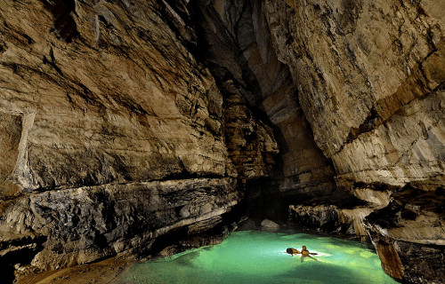
- First of all, this natural marvel developed into a cave system whose extent remains almost impossible to believe. This holds true despite its having a long history of use. Although nitrate miners have long used a few of the smaller surface caves, no one realized the marvels that lay further down.
- However, all this changed, to the amazement of the world, a few years ago. A team of intrepid explorers finally undertook the task of investigating the truly gargantuan system in 2012. In fact, these individuals spent more than a month within the cave system, doing just that.
- Nevertheless, many tunnels within Er Wang Dong still remain a mystery to explorers. So far, the total explored tunnel length has reached 138,251 ft (42,139 m). Finally, a cavern actually exists within its confines that formed so huge that it actually contains its own weather system.
Er Wang Dong Formation and Geology
The truly magnificent Er Wang Dong formed long ago. That’s due to the fact that it formed in what scientists call the Ordovician Period. This period lasted a total of nearly 45 million years, beginning roughly 488 million years ago.
Furthermore, the great majority of the walls, floors, and formations formed from comparatively soft native limestone. Subsequently, long-term erosion by steadily flowing water slowly carved out the incredible caves and tunnels.
This, however, only represented the beginning of the long process of formation. Later deposits of sandstone atop the soft limestone subsequently aided in preserving much of the incredible system as can still we see it today.
Finally, the next step took place within the cave system. That’s because countless stalagmites and stalactites, some of them rather huge, appear throughout the vast stretch of the entire system. The net effect makes for a stunning spectacle.
Er Wang Dong Distinctiveness and Meteorology
The absolutely mind-blowing marvel that locals named Er WAng Dong formed in what now constitutes the Chongquing province of China, in Asia. Perhaps the most astonishing feature of the site, however, remains to be mentioned. That would be what’s known as the Cloud Ladder Hall. This serves as the name of an enormous chamber with a total volume of roughly 549,000 sq ft (51,000 sq m).
To put this in perspective, this measures significantly larger than the area of St. Peters Basilica, both interior and exterior, in the Vatican City. Futher, the roof of this astonishing cavern measures roughly 820 ft (245 m) high. The height of the cavern and the amount of moisture inside has an incredible effect. Combined, these actually allow clouds to form near the ceiling.
Nevertheless, the awesomeness of Nature did not stop there. The floor of the gargantuan cavern remains covered with lush vegetation. Er Wang Dong also has yet another marvel to astound visitors. In fact, it contains a modest-sized underground river, as well as a relatively large sinkhole. Quite understandably, further explorations of this fabulous location are in planning.
Ha Long Bay
Ha Long Bay Facts
- The seventh and final of our 7 Geological Marvels of Asia is the absolutely breathtaking site known as Ha Long Bay.
- Without question, the remarkable and world renowned site forms an incredibly beautiful and picturesque location. This true marvel of Nature formed in an area already known for its beauty. That’s because this wonder is located in the Quang Ninh Province, of Vietnam, in Asia.
- Quite understandably, its majestic beauty has garnered it countless awards and appreciation. In fact, UNESCO designated this astonishing marvel of Nature as a World Heritage Site in 1994. Its nature also makes it one of the most frequently visited works of Nature in its region of the world.
- However, as is often the case, all this beauty did not just appear overnight. To be certain, fabulous Ha Long Bay formed slowly over a period of many millions of years. Furthermore, this incredible formation occurred due to a very specific combination of several natural processes.
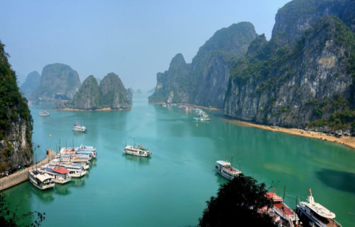
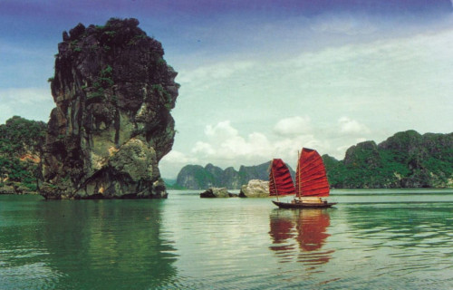
- These impressive processes included geological activity and erosion, including both wind and water. The magnificent Ha Long Bay also remains renowned for its incredible array of columns, karsts, and islets. Most of these primarily formed from comparatively soft local limestone.
CCL: http://bit.ly/2REt4fw
Ha Long Bay Geology
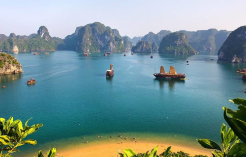
Magnificent Ha Long Bay also boasts some very impressive measurements, in addition to its breathtaking beauty and charm. For one, it covers quite a bit of area. In fact, the site includes an area measuring roughly 600 sq mi (1,553 sq km). This also includes a coastline totaling about 74.5 mi (120 km) in length.
Furthermore, within the confines of the bay also stands yet more wonders to be appreciated. These include approximately 2,000 small islands and karsts. In addition, the majority of these formations mainly consist of limestone. The greatest percentage of these also appear as monolithic in shape.
Incredibly several of the larger karsts and islands of Ha Long Bay are also essentially hollow. Many of these also contain extensive caves. Two of the islets have enough area to support small, permanent populations. Many of the smaller islands also possess comparatively large beaches along their perimeters.
Ha Long Bay Climate and Endemic Species
The wonders of stunning Ha Long Bay even extend to its climate. For the most part, this remains considered distinctly tropical. This comes with the presence of two distinct seasons. Summer remains moist and hot, while winter grows rather cold. Additionally, annual rainfall amounts averages around 78 in (2 m) in total.
Further adding to the splendor of this tiny and remote part of the world, most of the karsts have a covering of thick vegetation. Furthermore, most of the islets also boast extensive quantities of vegetation. A total of 14 recognized endemic species of flora also live across the islets and karsts Of Ha Long Bay.
To no great surprise, wildlife continues to be relatively abundant within the confines of the region. In fact, officials count a total of 60 known species of endemic fauna residing within the confines of the bay. Finally, much of the highly unique ecology of the bay now ranks as threatened by increasing tourism.
7 Geological Marvels of Asia
We sincerely hope that you have thoroughly enjoyed this article about 7 Geological Marvels of Asia. As you have seen, these wonders of the natural world present themselves in a myriad of ways for our appreciation. We hope that these few have served to whet your appetite for more. But, we must do all that we can to preserve these marvels for our posterity.
Check out our other articles on 7 Supremely Scintillating Cnidaria, 4 Stunning South American Woody Shrubs, Earth’s Many Astounding Beetles, 5 Phenomenal Sea Turtles


Leave a Reply