It’s our hope that each of you, our readers, will enjoy and appreciate this article we present about these 5 Stunning Islands of Europe. It was certainly our pleasure to gather the information for you. May it provide you with both education and increased awareness.
Certainly, these locations listed herein represent only a portion of the marvels found throughout this amazing region. It’s our belief, though, that they serve as excellent representations of the features found here. Check out some of our other articles, as well.
Madeira
Madeira Facts
- Leading off this article about these 5 Stunning Islands of Europe we present the captivating site known simply as Madeira.
- Perhaps most notably, the termused here serves as the name of both a breathtakingly beautiful island and archipelago with a unique distinction. That’s because it lies near one continent, but forms part of a country on an entirely different continent.
- This has the effect of making this marvel of geology an autonomous region of that country. That isn’t its only claime to fame, however. That’s due to the fact that the magnificent location also holds a special distinction in several historical terms.
- For starters, it’s believed to be the location mentioned by the Greek philosopher Plutarch, in 75 AD. Recent, and still ongoing, archaeological evidence also indicates that ancient Vikings visited the site, perhaps several times, between 900 and 1030 AD.
- In more recent times, Europeans first discovered the visually stunning Madeira in the year 1418. That holds true for the entire archipelago. This occurred when two ship captains in service to Prince Henry the Navigator were blown off course during a storm.
- Subsequently, the understandble influx of people quickly began to arrive. The first European settlers further arrived some time between the years 1420 and 1425. Currently, the magnificent site of Madeira constitutes an extremely popular tourist destination.
- In point of fact, more than 1.4 million visitors journey to the archipelago every year. That represents a staggering number. Due to its extraordinary beauty, though, portions of the archipelago also now hold the designation of a UNESCO World Heritage Site.
Madeira Physical Description
The sincerely breathtakingly beautiful site named Madeira is renowned for its natural beauty. This aspect of it quickly catches the eye of those lucky enough to journey to the site. In fact, it quite easily holds its own when compared to the rest of the formation.
That’s because, in itself, it forms the largest island of the awesome archipelago bearing the same name. That alone makes it worthy of note. This truly magnificent marvel of Nature also possesses a total geographical area measuring approximately 286 sq mi (740.7 sq km).
This single, visually magnficent, island actually comprises more than 75% of the total area of the entire amazing archipelago. Given the geographical location of this marvelous work of Nature, though, the origins of the archipelago should come as no great surprise.
That’s due to an amazing fact underlying the basic nature of this gorgeous product of time and powerful geological forces. This holds true due to the fact that the remarkable island actually represents the uppermost portion of an ancient shield volcano.
The massive formation of Madeira itself further boasts a stunning measurement. To be precise, it rises a phenomenal total of 3.7 mi (6 km) from the floor of the surrounding ocean. The volcano, and therefore the island, further formed about 5 million years ago.
Madeira Location, Geography, and Ecology
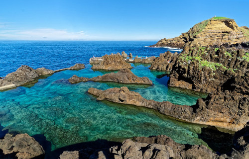
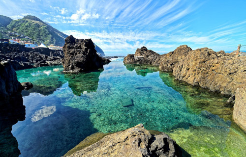
The gorgeous island named Madeira, along with the archipelago sharing the same name, formed in the area known as Macaronesia. This term applies to a loose grouping of four separate archipelagos located in the northern portion of the Atlantic Ocean.
More specifically, however, it lies off the coasts of both Europe and Africa. Officially, it forms part of the Portuguese Republic. There, this incredible site has amazing geographical features. The island itself also boasts an impressive 90 mi (150 km) of coastline.
Intriguingly, it also has a mountain range that runs through the center of the island. The highest point of this impressive range measures 6,109 ft (1,862 m). The beauty remains best known for its array of mind-boggling valleys, ravines, and coral reefs, and sea caves.
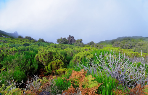
The magnificent Madeira also has a remarkably complex climate. That’s because, in fact, it has several microclimates, due to the variations in altitude. The only native fauna consists of a species of bat. Numerous animal species, however, have been introduced.
Yet its world-renowned natural beauty doesn’t merely end there, though. That holds true due to the fact that multiple plant species also appear on the island. These naturally occurring flora mainly consist of a moderately wide variety of ferns, cacti, vines, and shrubs.
Tenerife
Tenerife Facts
- Next up in this compendium of 5 Stunning Islands of Europe comes the gorgeous location going by the name of Tenerife.
- This gorgeous product of geological forces most frequently goes by the deceptively simple title we’re using. That’s typically the only appellation applied to this marvel of Nature. Yet that certainly in no way diminishes its sheer beauty and awesomeness.
- In ancient times, however, the stunning site held at least two separate, different names. That’s because the local Indigenous Peoples held their own monikers for the remarkable formation. In their native tongue, it was called either Chenet or Achinet.
- It’s presently unknown exactly when our ancestors discovered the beautiful island. In our era, however, that occurred relatively recently. Archaeological evidence uncovered indicates that the first human settlement began in approximately 200 BC.
- Today, the gorgeous Tenerife ranks as one of the most popular tourist destinations in its region. In fact, an extraordinary average of 5 million people visit the site annually. Fortunately, despite this, efforts remain in place to protect its pristine condition.
- Due to those efforts, several large protected areas now exist. Teide National Park, near the island’s center, is a UNESCO World Heritage Site. The Macizo de Anaga, an awesome massif, also holds the UNESCO designation of a protected Biosphere Reserve.
Tenerife Physical Description
The visually captivating Tenerife easily impresses and awes those fortunate enough to visit the site. Yet it does so for more reasons than just its sheer beauty, great though that is. That’s true since it also holds a remarkable combination of different geological features.
The island has a distinctive shape, somewhat reminiscent of a compressed, elongated triangle. Along with this unique design, it also boasts a highly irregular outline. Yet the same actions that created this structure also provided it with some impressive dimensions.
At its greatest extent, the island measures approximately 50 mi (80 km) in length. At its widest point, however, the formation only reaches roughly 31 mi (50 km) in width. The isle thus represents the largest of all the islands in the group of which it forms a part.
Due to these measurements, the site contains a surprisingly large total area. That dimension equals roughly 785 sq mi (2,034 sq km). Combined with the nature of its outline, this provides it with a remarkable shoreline. This aspect totals a startling 212.5 mi (342 km).
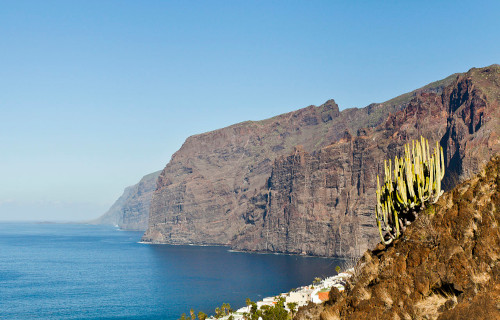
Yet, Nature gave the breathtaking Tenerife far more than just its size to amaze us. That’s true due to some of the individual features present within its confines. This includes Mount Teide, which ranks as the third-largest volcano on earth, when measured from its base.
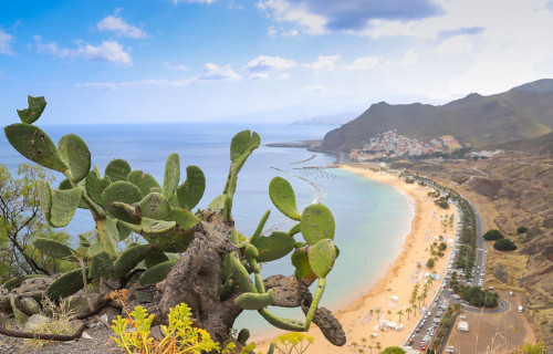
The location also plays host to numerous beaches. Some of these have sands of yellow, while others present pink, and a few even have black sand. Many of its shores also have a highly rocky nature. The entire island is known for its extremely uneven landscape.
Tenerife Location, Formation, and Ecology
Nature created Tenerife in a region of the globe already well known for its abundance of great geological beauty. Exactly where that section of the earth’s surface lies, however, might surprise a few people. It formed in the Atlantic Ocean, as part of the Canary Islands.
It further sits offshore from the continent of Africa, about 186 mi (300 km) from Morocco. Despite its proximity to this continent, though, it’s actually officially part of Europe. That’s because these islands collectively represent a territory of the country of Spain.
This stunning natural feature owes its creation to volcanic activity. This process actually began roughly 20 million years ago, however. Taking place beneath the ocean, this slowly built up a large cone-shaped structure, rapidly cooling due to the surrounding marine waters.
Evidence indicates that it finally expanded above the waves between 7.0 – 5.3 million years ago. A second powerful cycle of activity began around 3 million years ago, expanding its borders. This apparently continued sporadically until about 200,000 years ago.
In modern times, though, it’s only erupted four times. The first of these took place in 1704, with three cones erupting simultaneously. Then, in 1706, its largest modern eruption occurred, burying a small city and port. Minor events also occurred in 1798 and 1909.
Despite its size, Tenerife holds an extraordinarily diverse set of ecosystems. This is due to its combination of rich volcanic soil, and climatic and geographical conditions. Due to this, over 1,400 species of fauna exist here. In fact, 100 of these species appear nowhere else.
Animals also abound on the island. This includes 13 types of mammals, two amphibians, and five reptiles. Birds also live here in large numbers, comprised of 56 species. Roughly 400 varieties of fish also call the site home. Literally thousands of invertebrtes also appear here.
Corsica
Corsica Facts
- Our next choice for inclusion in this gathering of these 5 Stunning Islands of Europe is the famous marvel known as Corsica.
- This deceptively simple term Corsica serves as the english language name for this stunningly beautiful island. In French, though, it bears the very similar title of Corse. No matter which of these one uses, however, it remains a true geological marvel.
- The exact origin of the island’s name, in any of its major forms, though, remains something of a mystery. Archaeological evidence indicates that it’s been occupied since at least the Mesolithic era, which ran from approximately 15,000 to 5,000 years ago.
- One possible origin source for the title, and perhaps currently the most likely, comes from the time of the ancient Greeks. That civilization knew this natural wonder by several terms. These inclued the names of Corsis, Kalliste, Cyrnos, Cernealis, or Cirné.
- Ongoing scientific investigation further indicates that the first permanent inhabitation of the site began around 8,000 years ago. Prior to that, human presence was sporadic and temporary. In that time it’s hosted several different distinct civilizations.
- Today, the beautiful Corsica represents a prefecture of one of the countries on the local continent. It also distinguishes itself as the fourth-largest island in its immediate part of the world. It’s truly a work of geological art deserving of appreciation and protection.
Corsica Physical Description
The magnificent Corsica holds a beauty and appeal that almost immediately captivates those who see it for the first time. Yet that beauty takes many forms, with a variety of landscapes. As indicated previously, the formation also boasts some highly respectable dimensions.
The wonder of geological processes possesses a total area equaling roughly 3,368 sq mi (8,722 sq km). Its overall shape, though, is generally rectangular, but with highly irregular outlines. Overall, it measures 114 mi (183 km) in length, and 52 mi (83 km) at its widest point.
About 41% of that total area, however, is presently dedicated to nature reserves. Most of that lies in the interior section of the island. The landscape there consists of a combination of rugged hills, jagged peaks, forested regions, and deep ravines throughout the region.
The bulk of its area remains quite mountainous. In fact, a single mountain chain comprises fully two-thirds of its surface. The highest of these numerous peaks, Monte Cinto, measures 8,878 ft (2,706 m). Roughly 120 other surrounding summits exceed 6,600 ft (2,000 m).
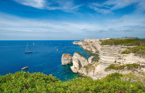
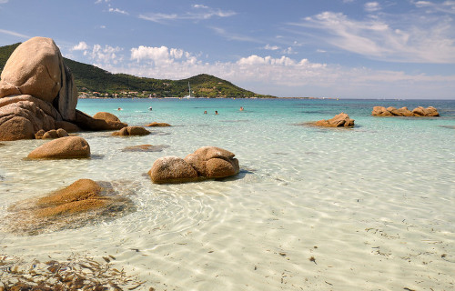
Yet the visual splendor of Corsica doesn’t simply end there. That’s because the site also contains 620 mi (1,000 km) of coastline. Along this expanse, over 200 individual beaches appear. Beautiful, often dense, forests further cover 20% of the surface area of the island.
Corsica Location, Formation, and Ecology
The mesmerizing island of Corsica formed in a region of the world already renowned for its abundance of natural marvels. In fact, that general area of the globe won’t surprise most people. That’s true since its creation placed it just off the coast of the continent of Europe.
The captivating site lies 110 mi (177 km) off the southeastern tip of France. That location also places it even closer to Italy, at just 56 mi (90 km) distant. Yet the closest landmass isn’t the continent. That’s because it sits just 6.8 mi (11 km) from the nearby island of Sardinia.
The island formed due to a combination of geological forces. In the beginning, movement of the local tectonic plate pushed a granite protrusion upward. Around 250 million years ago, the collision of Europe and Africa began this slow but inexorable, and ongoing, motion.
Subsequent to that, and much later, other factors came into play. Beginning around 50 million years ago, natural processess pressed enormous quantities of sedimentary rock against the granite. This action created much of what now comprises the soil of the island.
Various factors blessed the majestic Corsica with a remarkably wide range of ecosystems. In fact, this gem of natural forces boasts an impressive total of four separate and distinct ecological zones. Most experts roughly separate these different regions based on altitude.
The estuarine zone extends from seal level to about 33 ft (10 m). From there to 2,000 ft (600 m) it holds a definite Mediterranean climate. From there up to 5,900 ft (1,800 m), however, the site is a temperate montane zone. Next, up to 8,900 ft (2,700 m) lies the alpine zone.
The local flora abounds, and includes many flowers, grasses, shrubs, and trees such as pine, oak, and various deciduous trees and forests. Quantities of fauna also flourish here. This includes many bird species, as well as a surprising array of reptilians and amphibians.
Sardinia
Sardinia Facts
- Now showing in this compilation of 5 Stunning Islands of Europe comes the amazing work of natural processes named Sardinia.
- This breathtaking creation of time and geological processes most frequently goes by the deceptively simple name used here. It does have a few other titles, though, in other tongues. These include the monikers Sardigna, Sardenya, Sardhigna, and Saldigna.
- Each of these similar yet different titles, however, represent versions in the traditional languages of several small populations within select regions within the greater area. At least separate such local tongues exist, though they’re all gravely endangered.
- Archaeological evidence indicates a human presence on the island dating back to the end of the Paleolithic, or Old Stone Age. These findings therefore place the first human knowledge and use of the site at somewhere between 20,000 – 10,000 years ago.
- The indigenous Nuragic civilization ruled it flourished there from the 18th century BC to the 6th century AD. The Romans subsequently conquered and ruled it for several centuries. During the Middle Ages, however, the Vandals and Byzantines held it.
- Today, magnficent Sardinia ranks as one of the loveliest islands in its entire region. The site’s also the second-largest island in its part of the world. It’s additionally widely respected for its incredible variety of ecosystems contained within its borders.
Sardinia Physical Description
The stunning Sardinia captivates most of those fortunate enough to visit the amazing site. It does so, however, due to more than just its sheer beauty, impressive though that is. That’s because this natural marvel also contains some impressive physical attributes.
The island possesses a roughly rectangular shape. In length, the wonder measures approximately 170 mi (270 km). Its width, though, reaches only 90 mi (145 km) at its greatest point. These further provide it with a total area equaling about 9,300 sq mi (24,090 sq km).
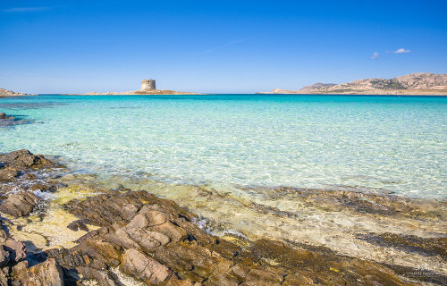
The high degree of irregularity of its outline also provides this geological masterpiece with yet another remarkable statistic. That pertains to its beautiful shoreline. Given the existence of this pattern, the island has a total coastline measuring 1,149 mi (1,849 km).
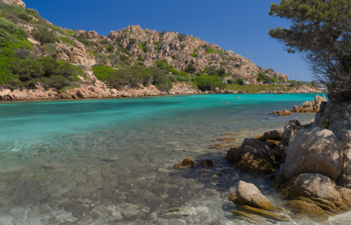
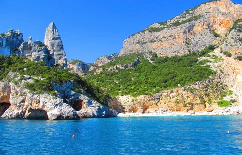
As a general principle, the majority of this coastline has a rugged, high, rocky structure. Mixed in with this characteristic, however, are numerous comparatively straight sections of beaches. Multiple small inlets and a handful of relatively broad, deep bays also appear.
Yet, Nature isn’t finished with Sardinia. That’s true since the site also contains many quite respectable mountains. Punta La Marmora, the highest point on the island, sits in the middle part of the island. It stands 6,017 ft (1,834 m) tall. Other, though shorter, one’s also exist.
The formation additionally contains multiple rivers, though only a few of them qualify as major. The longest holds the name of the Tirso. It measures 94 mi (151 km) in length. Only one natural freshwater lake exists, along with many shallow saltwater lagoons and pools.
Sardinia Location, Formation, and Ecology
The mesmerizing Sardinia formed in a region of the earth’s surface well known for its abundance of geological marvels. Due to that, it exact location probably won’t surprise many people. That’s because Nature situated the island in part of the Mediterranean Sea.
Within that greater range, however, it sits of the western coast of Italy, in Europe. Its geographical placement also puts it north of Tunisia, and south of the island of Corsica, a part of France. In fact, the two islands sit only about 132 mi (213 km) apart at their closest.
Intriguingly, unlike the nearby mainland, it’s not prone to earthquakes. It’s comparatively stable, due in large part to the nature of its origins. Those date back to a period roughly 500 million years ago. This action occurred due to tectonic action, rather than volcanic.
That action thrust an enormous outcropping or rock, chiefly composed of granite, basalt, and sandstone, up from the seafloor. The slow yet inexorable process of erosion by rain and wind eventually carved the features it has today. Technically, the process remains ongoing.
The climate of the captivating Sardinia varies from one region to the next. This creates an extremely wide variety of ecosystems. Forests abound, though, covering roughly half the surface area. Many of the species of tree within these appear nowhere else on the planet.
Many mammals, birds, reptiles, and invertebrates also naturally reside here. Much like the flora, many of these live in no other part of the world natively. This includes several types of salamanders and lizards, among others. Tortoises and birds also appear in large numbers.
Rügen Island
Rügen Island Facts
- Finishing out this article about these 5 Stunning Islands of Europe we give you the magnificent location best known as Rügen Island.
- The deceptively short term applied herein serves as the only commonly used title for this marvelous geological formation today. It held other monikers in the past, however, in other tongues. These included Rugia, in Latin, and Rȯjana in the Rani tongue.
- Archaeological evidence indicates that humans knew of and lived on the island since the latter part of the Stone Age. That occupancy appears to have began sometime around or after 10,000 years ago. This evidence includes megalithic tombs and altars.
- Beginning in the 7th century, though, the Rani civilization built their own empire, centered on the site. For a period of time, they dominated the region. Their empire, in fact,survived until well into the 12th century. Many signs of this remain today.
- In our modern era, the stunning Rügen Island continues to garner much appreciation. Due to its great natural beauty, it forms the most popular tourist destination in the country in which it lies. Thankfully, efforts are taken to maintain its natural state.
- These include the establishment of two beautiful National Parks and one extensive Nature Reserve. One of these parks, in fact, holds a special prestige. That’s because, in 2011, UNESCO named Jasmund National Park a World Heritage Site.
Rügen Island Physical Description
The majestic Rügen Island boasts many wonders to dazzle those fortunate enough to visit the site. Its size and shape certainly rank among these. That’s due to the combined facts that the island contains both a respectable area and a highly distinctive general shape.
In overall design, it has a slightly rectangular shape. In maximum length it measures roughly 31.94 mi (51.4 km). Its width, however, differs only slightly, at 26.59 mi (42.8 km). These dimensions provide the marvel with an area of roughly 357.7 sq mi (926.4 sq km).
Yet, it also hosts multiple sizeable peninsulas. To the north, the major one’s bear the names of Jasmund and Wittow. They’re connected by a large sandbar in places, yet separated by lagoons in others. In the south, Zudar and Mönchgut stand out for facing a large bay.
These features, themselves impressive, combined with an extraordinarily irregular outline, provide this creation of geological forces with yet another amazing statistic. That’s because it has an incredibly extensive coasline. This totals a remarkable 356.7 mi (574 km).
Yet, Nature didn’t stop there in its work with the remarkable Rügen Island. That’s true since the formation also contains numerous other marvelous natural features. Along with the aforementioned lagoons, a large number of beaches of varying sizes also dot its shoreline.
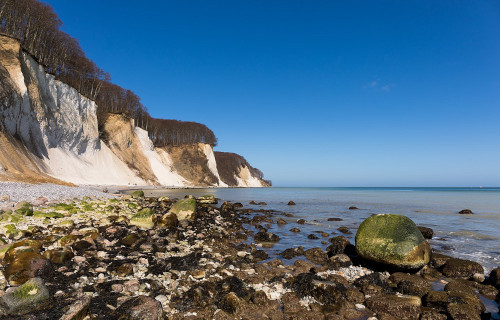
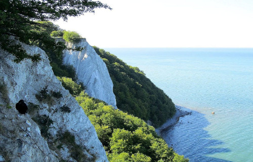
It’s perhaps best known for the presence of a certain type of cliff formation, however. On the Jasmund Peninsula, large, extensive chalk cliffs line the coast. The most famous of these holds the translated name of Kings Chair. This example reaches a height of 387 ft (118 m).
Rügen Island Location, Formation, and Ecology
The breathtaking Rügen Island formed in a region of the globe already quite famous for it abundance of magnificent geological features. That precise section of the earth therefore likely won’t surprise many people. That’s because it sits within the confines of Europe.
Being an island, though, this site obviously lies outside the continental borders themselves. Its creation placed it in the marine region that now bears the name of the Baltic Sea. Its placement puts it almost equally off the shores of the countries of Poland and Germany.
The origins of this lovely location reach far back in the past. Unlike some similar features in its part of the world, however, it’s not volcanic in nature. Instead, it owes its creation to the slow yet inexorable upward motion of tectonic activities also present in the region.
In its case, this began at some point during the late Cretaceous Period. This puts the island’s beginnings at somewhere between 72 – 66 million years ago. It’s unknown, though, at precisely what point in time the island reached the state at which it exists now.
The beautiful Rügen Island posesses a decidedly temperate, Mediterannean climate. Thus, numerous forests thrive here, primarily comprised of varieties of beech. Other trees also appear, of course, in addition to flora such as Honeysuckle and Lily of the Valley.
Multiple species of fauna also abound in this location. Large numbers of migratory birds of many types appear, such as the European Honey Buzzard. Nesting water birds also make an appearance. Insects live here in quantities, too, such as the northern dune tiger beetle.
5 Stunning Islands of Europe
We hope that each of you enjoyed reading, and hopefully learning from, this article we’ve written about these 5 Stunning Islands of Europe. It’s also our hope that doing so has left you with either a new or renewed appreciation for such wonders of Nature.
Unfortunately, many other such features around the world now find themselves facing threats to their continued existence in an undamaged state. Many of those dangers, in fact, stem from the actions of mankind. We must do all we can to protect and preserve them all.
Check out our other articles on 7 Breathtaking East Coast Wonders, Spectacular Dolphins Throughout Our World, 4 Supremely Stunning Squirrels, The Mighty Tornado


Leave a Reply