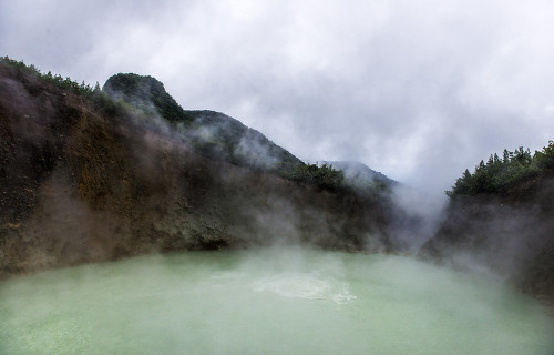
It’s our hope that each of you, our readers, will enjoy and appreciate this article we present about these 5 Fabulous South American Lakes. It was certainly our pleasure to gather the information for you. May it provide you with both education and increased awareness.
Certainly, these locations listed herein represent only a portion of the wonders found throughout this amazing region. It’s our belief, though, that they serve as excellent representations of the marvels found here. Check out some of our other articles, as well.
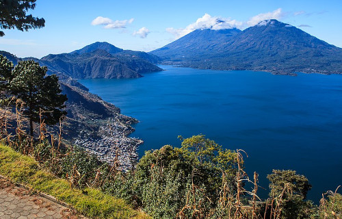
Lake Atitlan
Lake Atitlan Facts
- Leading off this article about these 5 Fabulous South American Lakes we present the marvel simply known as Lake Atitlan.
- This beautiful product of geological processes is mainly known to those who know of it by the name used here. That’s the english language translation of its title, though. In the Spanish language, however, that translates to the term Lago de Atitlán.
- Both of these modern names derive quite closely from its original moniker. That sprang from the native tongue of the local Indigenous Peoples of its region. In the language of that People, the Nahuatl, the term approximately means “between the waters.”
- The awesome formation holds note for a variety of reasons. Among these remains the fact that it qualifies as the deepest lake in its part of the world. Yet this wonder of the natural world also ranks as the third largest by volume in that same region of the globe.
- This beautiful and distinctive lake also plays an important role in the culture of the area. In ancient times, it served as a prominent feature in the local Mayan culture. Amazingly, in many of the surrounding small villages, that culture remains prevalent.
- The stunning Lake Atitlan continues to be considered by many to be one of the most beautiful in the world. It thus naturally now serves as an important source of tourism in the area. It’s also become renowned as a location for cliff diving in recent decades.
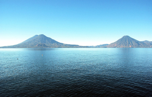
Lake Atitlan Physical Description
Gorgeous Lake Atitlan certainly earns the appellation. Yet it also merits appreciation for more than just its beauty, though that’s present in great quantity. This holds true due to the fact that this body of water also boasts some highly respectable physical measurements.
It’s irregular in shape, of course, as most such formations are. Overall, however, it possesses a roughly rectangular structure. The visually pleasing lake measures roughly 11.2 mi (18 km) in length. The formation also has an approximate width of about 5 mi (8 km).
Combined, these two separate dimensions provide the geological marvel with a total surface area deserving respect. That aspect of the water body totals about 50.2 sq mi (130.1 sq km). This volume of water actually currently fills a gigantic ancient volcanic caldera!
It’s additionally quite deep in some parts of its area. The maximum known depth of the lake reaches down 1,120 ft (340 m). Overall, though, its waters maintain an average depth of 505 ft (154 m). This provides it with a total volume measuring 4.8 cubic mi (20 cubic km).
As if Lake Atitlan needed anything else to add to its impressive statistics, there’s more. It also sits surrounded by two separate distinctive geological features. These consist of a deep escarpment on one side, and on the other lies three equally impressive volcanoes.
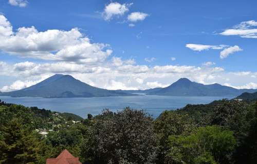
Lake Atitlan Location, Formation, and Ecology
The magnificent Lake Atitlan formed in a region of the world renowned for its abundance of geological wonders. That general area of the globe won’t surprise many people. However, the precise section of that greater area might. It sits in what’s now the country of Guatemala.
More precisely, within the boundaries of that country in Central America, the lake’s situated in an isolated area. That’s the Guatemalan Highlands section of the Sierra Madre mountain range. That places this natural formation in the southwestern portion of the country.
Evidence places the first beginnings of its creation at about 11 million years ago. Research additionally indicates that since that time, at least four separate episodes of volcanic growth and caldera collapse have occurred. The latest happened about 1.8 million years ago.
The most recent known eruption took place 40,000 years ago. Subsequent to that latest activity, the lake itself formed over the last 10,000 years. It forms almost entirely from flows originating with two separate rivers. Rainfall also plays a smaller role in maintaining it.
The presence of Lake Atitlan serves to help maintain a thriving ecosystem surrounding it. An impressive total of 798 known species of flora appear around the site. That includes large forests of pine, oak, and conifers. Of these plants, a total of 61 evolved as endemic.
Given this, numerous species of animals also appear here. That includes 116 known amphibians and reptilians. At least 236 types of birds also live here, 28 % of which are Threatened. An impressive 141 mammalian species also make their home around the lake.
Laguna Verde
Laguna Verde Facts
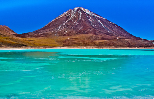
- Next up in this collection of 5 Fabulous South American Lakes comes the visual masterpiece bearing the name of Laguna Verde.
- In the native language of the region in which it formed, this breathtaking body of water most frequently goes by the name given herein. This translates into english literally as green lake. The name’s certainly descriptive, and appropriate for the formation.
- Despite its extreme beauty, tourist activity in the region remains limited, though only in relative terms. It actually ranks among the most frequented of locations for tourist visits in the country in which it lies. The reason for that’s relatively simple, however.
- The body of water lies within the confines of the Eduardo Avaroa Andean Fauna National Reserve. This makes it a somewhat remote destination. However, the fact that this places the lake in the approximate middle of the Andes further limits visitation.
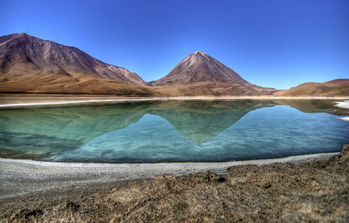
- Augmenting its visual appeal further is the surrounding landscape, as one can plainly see from this image. That’s because it clearly lies at the base of a majestic mountain. That mountain, though, is actually the volcano bearing the name of Licancabur.
- Being presently considered as dormant, having this as a backdrop merely enhances the magnificence of Laguna Verde. The combination leaves the site generally considered by many to be among the greatest geological marvels of this region of the globe.
Laguna Verde Physical Description
The mesmerizing beauty of Laguna Verde exists on its own merits, wholly regardless of any other physical characteristics. That fact’s plainly obvious to any and all who visit its shores. Yet its other traits bear mentioning in any discussion of the amazing site, of course.
The incredible body of water further has a highly elongated overall shape. It also has an irregular, and somewhat variable, outline. The lake’s also divided into two sections by a relatively narrow causeway. This provides it with a stretched-out figure eight shape.
It also manages to compress such natural beauty into a small site. That’s because, aside from that appeal to the eye, its other attributes remain modest. Thankfully, though, Nature has never felt restricted to combining size and beauty in its many constructions.
The marvelous Laguna Verde possesses a total average surface area of approximately 2.9 sq mi (7.5 sq km). This varies slightly, of course, due to such factors as rainfall and evaporation rates. It remains quite shallow, however. The lake has an average depth of 18 ft (5.4 m).
It’s the tantalizing hues of the body of water that garner the most attention, however. This comes from the suspension of high levels of several minerals, including arsenic! This thus results in a range of brilliant colors that varies from turquoise to a dark emerald shade.
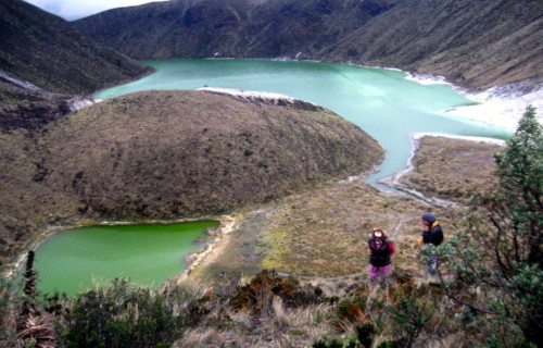
Laguna Verde Location, Formation, and Nature
The eye-catching lake known appropriately as Laguna Verde formed in a region of the globe well known for its abundance of geological marvels. That’s due to the fact that natural processes created it in an area of what now constitutes South America.
More precisely, the lake sits in the country of Bolivia. It’s also quite close the border with the country of Chile. This places the natural wonder in the Sur Lípez Province of the Potosí Department. This puts it in a remote, and comparatively rugged, region.
Technically considered a salt lake, it further formed in a naturally occurring drainage basin, quite close to the dormant volcano that so dominates the local skyline. It also sits at an astounding altitude of 14,140 ft (4,310 m). Snowfall therefore forms part of its source.
The majority of its water, however, comes from another origin. Geothermal activity still present beneath the site provides it with a natural inflow of water from hot springs. Despite the altitude, its water therefore maintains an average of 55-68 F (13-20 C).
Due to the slight toxicity of its waters, wildlife is absent from Laguna Verde. It nevertheless has other marvels to draw the tourist, in addition to its green shade. Numerous geological structures, known as stromatolites, dot the region, though they’re now inactive.
Researchers estimate that these structures formed between 20,000-10,000 years ago, though. Presently, however, other, smaller structures of a different nature still appear. These consist of microbial mats, formed by the actions of specialized bacteria in the water.
Boiling Lake

Boiling Lake Facts
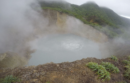
- Our next choice for inclusion in this gathering of 5 Fabulous South American Lake is the extraordinary body of water named Boiling Lake.
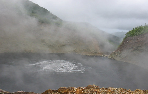
- This astonishing creation of natural forces typically, and understandably, goes by the common name due to its nature. Perhaps the most noteworthy fact about this geological marvel in the minds of many is its extremely unusual impressive status.
- That’s because the wonder of Nature ranks as the second-largest hot lake in the world. Due in part to that fact, the site currently enjoys a certain degree of protection. It now forms part of the Morne Trois Pitons National Park, presently a World Heritage Site.
- This remarkable formation also has a rather impressive recent history. This holds true due to the fact that the first recorded sighting of this marvel occurred in the year 1870. That occurred due to the efforts of Edmund Watt and Henry Nicholls.
- The first scientific investigation of the site took place not long after, in 1875. It was because of this that its remarkable qualities came to light. Not only does the aptly-named formation remain extremely unique, but it holds another notable claim.
- That’s because the location of Boiling Lake also ranks as somewhat remote. In point of fact, the nearest road sits about 8.1 mi (13 km) from the site. Access therefore remains quite limited. That’s perhaps fortunate, since the site also stays fairly active.
- Due to this, it will occasionally drain, and even form geyser-like fountains of hot water and steam. Sometimes, the body of heated water will even empty and refill amazingly fast. Amazingly, this complete cycle sometimes occurs in only a single day.
Boiling Lake Physical Description
The dimensions of the descriptively-named Boiling Lake remain constantly variable. This occurs largely due to local conditions. Typically mild phreatic eruptions in the region occur periodically. Understandably, these dramatically affect the level of the small lake.
Despite this variable nature, its diameter still manages to maintain a fairly regular size range. As a result, it averages between 200-250 ft (61-76 m) across. That’s quite large compared to most other features of its kind throughout the world, and is a distinguishing aspect.
The depth of the body of water naturally also varies, due to the same processes. However, an average depth has been determined to be about 195 ft (59 m). This, of course, understandably only applies to those times when the intriguing lake is fully formed.
The color of the water in Boiling Lake also frequently varies. These stunning hues change, sometimes becoming green. But these remarkable colors usually range from grayish-blue to bright blue. The temperature of its water ranges between 180-197 F (82-92 C).
This flooded fumarole sits amid jagged, formidable outcroppings of rock. These dangerous features themselves average approximately 100 ft (30 m) in height. In addition to the ever-present steam, the site also occasionally spews forth various noxious gases as well.
Boiling Lake Location and Formation
The beautiful yet dangerous Boiling Lake formed in a region of the globe well known for the presence of various natural wonders. That exact location might surprise some individuals, though. That’s because it does not reside on any of the continents of the earth.
As the previous statement implies, the extraordinary body of water sits on an island, not the mainland. More precisely, it’s found on the island nation of Dominica. There, its precise location places the wonder approximately 6.5 mi (10.5 km) east of the town of Roseau.
The island itself, furthermore, lies in the Caribbean Sea. One of its closest neighbors, lying to the northwest, is the island of Guadeloupe, an overseas department of France. Martinique, another nearby neighbor, lies roughly south-southeast of the island.
Given the nature of its origins, the fascinating natural site not only has the distinction of being remote, but the surrounding terrain also presents extremely rugged conditions. The water of the lake itself additionally originates from two entirely separate sources.
These consist of plentiful rainfall and two small streams that flow into the site. As a result of this, the water of Boiling Lake becomes super-heated by proximity to the underlying magma chamber. However, the appearance of the water itself is independent of this action.
This occurs because various combinations of minerals present in the water create the dazzling color. Being comparatively porous in nature, the surrounding rocks also allow the water to escape rapidly when the nearby volcanic activity interrupts the regular inflow.
Lagoa do Fogo
Lagoa do Fogo Facts
- Here, in this compendium of 5 Fabulous South American Lakes we give you the natural wonder named Lagoa do Fogo.
- The term we use here serves as the most freuquently used name for this remarkable creation of geological processes. The formation also has another title it’s known by, though. That’s because it also holds the less-often used name Lake of Fire.
- The major credit for the discovery of this majestic site in more modern times typically goes to Portuguese explorers. Records show that they first encountered the location in 1427. That occured during the heyday of European exploration of the world.
- Scientific evidence does now exist that indicates others found it earlier, however. These discoveries clearly show, in the minds of many researchers, that ancient Viking explorers visited it as much as 700 years prior to the arrival of the Portuguese sailors.
- Neighboring islands, though, show indications of human presence going back even further. That suggests the possibility of their visiting Lagoa do Fogo. Their identity is unknown, but signs of a human presence in the area date back almost 2,000 years.
- Thankfully, today the magnificent location enjoys a certain amount of legal protection from the depradations of man. National legislation designated the lake as a protected area in 1974. That same action formed the Reserva da Lagoa do Fogo.
Lagoa do Fogo Physical Description
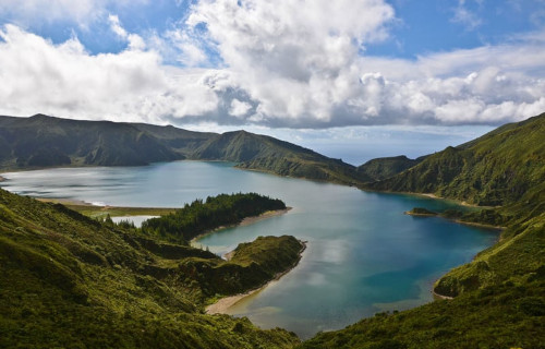
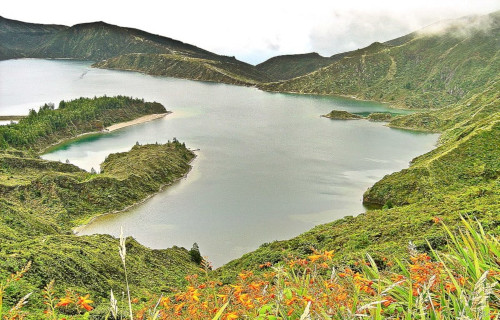
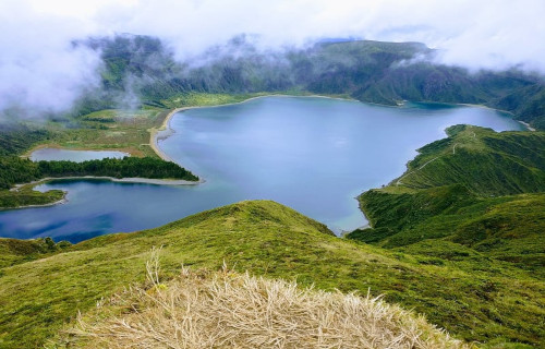
The stunning Lagoa do Fogo immediately captivates the vast majority of those fortunate enough to visit the site. Obviously, it principally does so due to its sheer natural beauty. Yet the gorgeous creation of Nature also garners appreciation for its geological nature.
Amazingly, the body of water lies within the caldera of an extinct stratovolcano, which in turn is also part of the Agua de Pau Massif. Though understandably highly irregular in its outline, the overall shape of the impressive body of water remains slightly rectangular.
At its greatest, the lake measures approximately 1.9 mi (3.0 km) in length. Its widest point, meanwhile, comes in at roughly 1.5 mi (2.4 km). Factoring in all its irregular dimensions, the remarkable water body possesses a total surface area equaling about 2.85 sq mi (4.56 sq km).
Yet the wonders of Lagoa do Fogo do not simply end there. That’s true due to the fact that Nature provided it with other marvels. In one location, deposits of sediment actually formed a small beach along the perimeter of the lake. It also boasts a depth of 98 ft (30 m).
Lagoa do Fogo Location, Formation, and Ecology
Majestic Lagoa do Fogo formed in a general region of the globe renowned for its abundance of natural wonders. The precise area of the globe may surprise some people, though. That’s due to the fact that it lies on an island situated in the north Atlantic Ocean.
That island, named São Miguel, forms part of the archipelago known as the Azores. Amazingly, though, it actualy lies within the crater of an ancient volcano. Geographically, both this structure and the dazzling lake itself sit in the immediate center of the island.
The caldera in which it sits obviously formed first. That occurred around 15,000 years ago. Subsequent to that, the top collapsed roughly 5,000 years ago. The last eruption of the parent volcano took place in 1563. It’s been quiet since, thus allowing the lake to form.
The water within the confines of the intriguing lake comes purely from the frequent, and occasionally torrential, rains common to the region. Over the centuries, Nature achieved a natural balance between evaporation and the influx of freshly deposited rainfall.
Lagoa do Fogo serves to support an important biome. The one the south and west side is a concentration of scrub and brush. But on the north and east side lies dense vegetation and a small forest. Numerous species of flora and fauna endemic only to the Azores live here.
A wide variety of bird species constitutes the primary animal life within the area. This includes both terrestrial species as well as seabirds. Impressively, for many of these avian species, the lake supports the largest breeding and habitat area in the entire region.
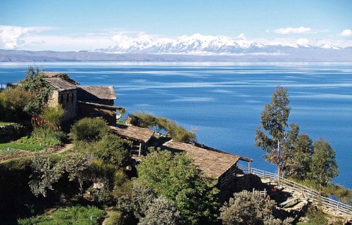
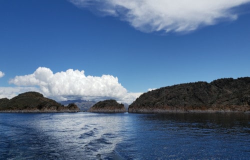
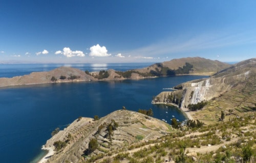
Lake Titicaca
Lake Titicaca Facts
- Closing out this article about these 5 Fabulous South American Lakes is the breathtaking natural formation holding the name of Lake Titicaca.
- The almost poetic term applied herein serves as the most frequently used name for this gorgeous product of natural forces. It represents the english language term for the site. It has other modern names, though, including Lago Titicaca, in Spanish.
- In the native tongue of the local Indigenous Peoples of the region, however, it originally bore another title. The ancient Quecha people long knew the body of water as Titiqaqa Qucha. Most of the modern appellations for the site derive from this.
- This marvel of geological forces stands out from similar features around the world for several reasons. Due to its location, it’s also often referred to as the highest navigable lake on the planet. This refers to its ability to contain commercial vessels.
- Its very placement qualifies the stunning Lake Titicaca as distinctive. Yet it further distances itself from other lakes in other qualifications. That’s because it additionally contains the largest volume and surface area of any lake on its continent.
- Thankfully, there’s hope for its future. This wonder of the natural world now enjoys a certain measure of protection from the depredations of mankind. The government of the region named the entire body of water a National Reserve in 1978.
Lake Titicaca Physical Description
The magnificent Lake Titicaca fully deserves the appreciation it receives from those who view or visit the site. Yet it does so for more than just its beauty, as many such sites do. That’s due to the fact that the water body also boasts some remarkable dimensions.
It’s actually divided into two separate subbasins. Astonishingly, the strait that connects them, named the Strait of Tiquina, only measures 2,620 ft (799 m) wide at its narrowest point. This creates a highly unique outline for the beautiful lake that must be seen.
The larger of the two sections holds an average depth of 443 ft (135 m). Impressively, its maximum depth equals 932 ft (284 m). Meanwhile, the other section is both much smaller and shallower. Its mean depth measures 30 ft (9 m), with a maximum depth of 131 ft (40 m).
At the maximum measured point, dazzling Lake Titicaca extends roughly 118 mi (190 km) in length. But its greatest width only reaches about 50 mi (80 km). Overall, this stunning formation possesses a total surface area of approximately 3,232 sq mi (8,372 sq km).
Its highly convoluted outline also provides it with a remarkably extensive shoreline. This aspect stretches out for a total of 699 mi (1,125 km) around the perimeter. Given these statistics, the lake contains a staggering water volume of 215 cu mi (896 cu km)!
Lake Titicaca Location, Formation, and Ecology
The marvelous Lake Titicaca formed in a section of the globe well known for its plethora of geological wonders. Yet the precise portion of that greater area might surprise many people. For starters, its creation placed it within the borders of the continent of South America.
More specifically, it’s found in the general western section of the landmass. It roughly straddles the borders of the countries of Peru and Bolivia. Perhaps the most amazing fact pertaining to its location is that it sits high in the stunning but rugged Andes Mountains.
The basin in which it sits, named the Tinajani Basin, formed due to the actions of regional faults sometime between 34 – 5 million years ago. The best approximation of its exact period of formation by geologists places that action at around 27 – 20 million years in the past.
The waters of the breathtaking lake itself primarily come from the steady inflow of five major rivers. More than 20 smaller streams also add to this remarkable influx. Rainfall across its large expanse adds an average of another 2.6 – 3.9 ft (0.8 – 1.2 m) to this per year.
Lake Titicaca typically possesses a very strong alpine climate. The temperature stays cool to cold throughout the year. Despite this, the lake itself serves as home to more than 530 aquatic species. Large numbers of waterbirds also call the intriguing formation home.
Many animal species also appear here, with some being found nowhere else, such as an endemic frog. Several currently unidentified species of bivalves make their home in the lake, as well. These creatures are currently being studied as possibly previously unknown species.
5 Fabulous South American Lakes
We hope that each of you thoroughly enjoyed reading, and hopefully learning from, this article we’ve written about these 5 Fabulous South American Lakes. It’s also our hope that doing so has left you with either a new or renewed appreciation for such wonders of Nature.
Unfortunately, many other such features around the world now find themselves facing threats to their continued existence in an undamaged state. Many of those dangers, in fact, stem from the actions of mankind. We must do all we can to protect and preserve them all.
Check out our other articles on 4 Gorgeous European Gorges, Africa’s Many Geological Masterpieces, 3 Amazing North American Amphibians, The Mighty Tornado


Leave a Reply